ROUTE SURVEY & LIDAR MAPPING SOLUTIONS
ROUTE SURVEY & LIDAR MAPPING SOLUTIONS
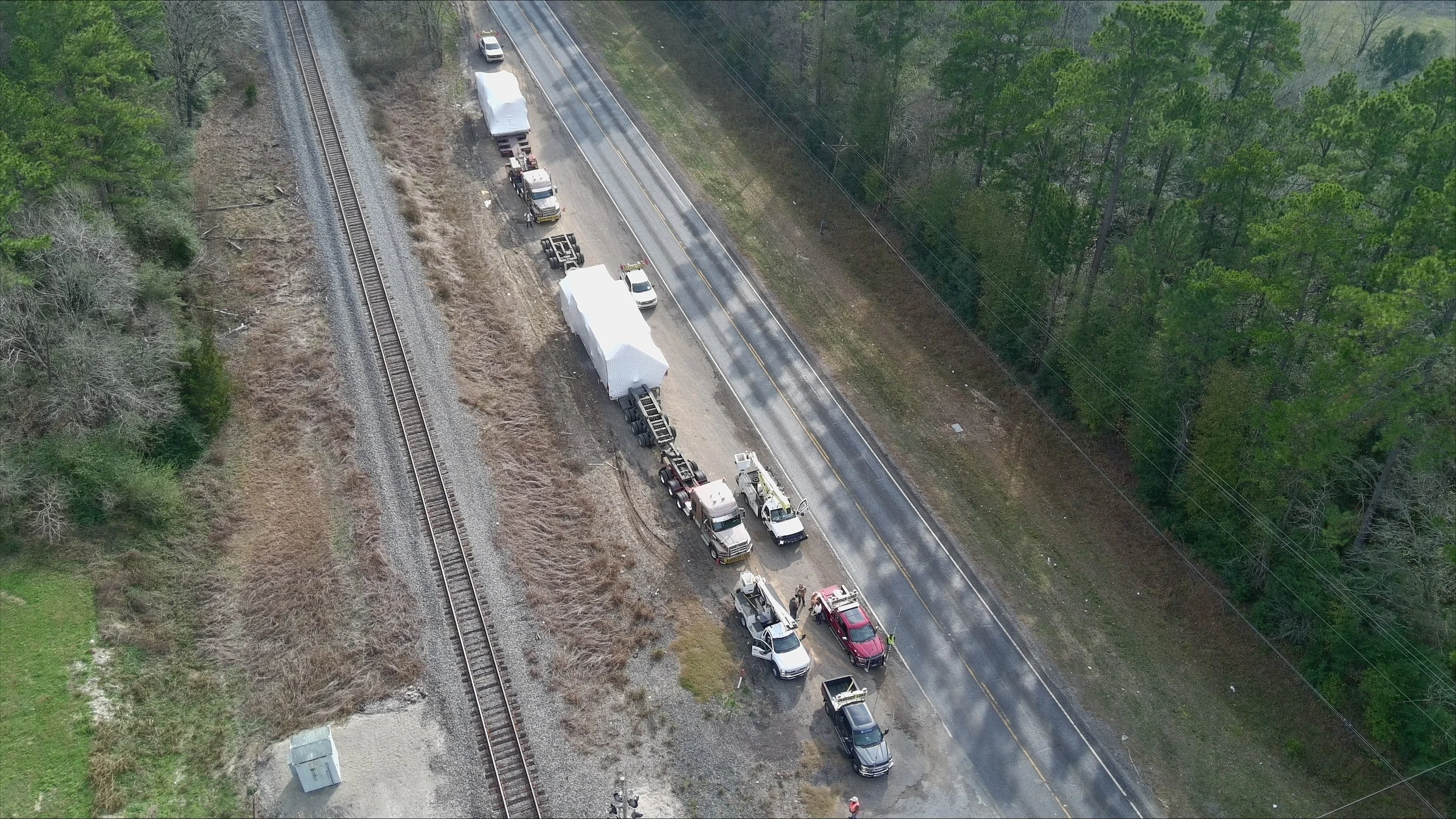
Rangeland provides comprehensive route survey and LiDAR mapping services to support the safe, compliant, and efficient movement of oversize, overweight, and specialized loads across North America. Operating from Edmonton, Calgary, and Houston, our team combines field experience with advanced scanning technology to deliver precise, data‑driven route assessments tailored to heavy haul and industrial transport.
Whether planning a single high‑risk move or coordinating a multi‑state/province heavy haul project, Rangeland ensures every route is evaluated, validated, and engineered for safety.
Complete Route Survey Services
Our route surveys identify operational constraints, safety risks, and compliance requirements before transport begins. Services include:
Full pre‑trip and on‑site route inspections
Bridge, overhead, and structural clearance measurements
Road grades, surface conditions, and width evaluations
Turning radius, intersection geometry, and access checks
Swept Path Analysis (SPA) for validating maneuverability of oversize and multi‑axle trailer configurations
Utility line, signal light, and overhead obstruction assessment
Identification of hazards, conflict points, and traffic patterns
Safe staging areas, bypass lanes, and turnout locations
Detailed written and visual documentation for planning and permitting
Swept Path Analysis is now formally embedded as part of the core route survey process, ensuring every turn, intersection, and maneuver can be completed safely with the planned equipment.
Every survey follows a standardized, safety‑driven process designed to eliminate surprises and reduce transport risk.
LiDAR Technology for Precision Mapping
Rangeland leverages LiDAR (Light Detection and Ranging) technology to capture high‑resolution, three‑dimensional route data with unmatched accuracy.
LiDAR‑Enhanced Capabilities
3D mapping of roads, terrain, and infrastructure
Precise overhead clearance measurements within millimeters
Full scan of power lines, bridges, signals, and overpasses
Digital modeling of tight turns, intersections, and roundabouts
Georeferenced route profiles for engineering and planning
High‑detail point cloud data for complex heavy haul requirements
LiDAR provides a true‑to‑life digital replica of the entire route — eliminating guesswork and enabling informed decision‑making.
Engineering & Heavy Haul Support
Our data is used to develop engineered transport plans for oversized and overweight loads. This includes:
Computer‑based route modeling and obstacle analysis
Transport feasibility and risk assessments
Clearance simulations for height and width
Trailer configuration and axle spacing recommendations
Multi‑crane lift and jack‑and‑slide coordination (if required at origin/destination)
Detailed reporting for permitting authorities and utility companies
When required, we provide engineered drawings and documentation to support complex moves.
Integration with Pilot, Escort & Heavy Haul Operations
Rangeland’s route survey team works hand‑in‑hand with:
Pilot and escort vehicle services
Heavy haul & specialized transport
Crane and rigging divisions
Winch truck and oilfield hauling teams
3PL transportation planning
This integrated approach ensures that each route is not only surveyed but executed safely and efficiently with consistent communication across all teams.
Industries Served
Our route survey and LiDAR mapping services support:
Heavy industrial equipment transport
Oilfield and drilling rig mobilizations
Pipeline equipment and large‑diameter pipe
Plant modules and prefabricated structures
Transformers, turbines & power generation equipment
Oversize construction machinery
Wind energy components
Specialized project freight
If it’s oversized, overweight, or high‑risk — we ensure it moves safely.
Safety at Every Step
Safety is the foundation of every Rangeland survey. Our practices include:
Certified survey personnel
Standardized pre‑survey hazard assessments
Real‑time communication with logistics teams
Detailed reporting with photos, maps, and digital scans
Identification of hazards and mitigation strategies
Validation of controlled‑travel or restricted‑access segments
We do not approve a route unless it meets strict safety and engineering standards.
Why Choose Rangeland Route Survey & LiDAR Services
Advanced LiDAR mapping for unmatched accuracy
Certified field surveyors with industrial and heavy haul expertise
Seamless integration with pilot, crane, and hauling operations
Engineered planning for complex and high‑risk moves
Clear, detailed reporting with actionable insights
Rapid deployment from Edmonton, Calgary & Houston
Reliable communication and professional execution
From preliminary assessments to fully engineered heavy haul route plans, Rangeland delivers the precision, technology, and expertise required to move your project forward safely.
